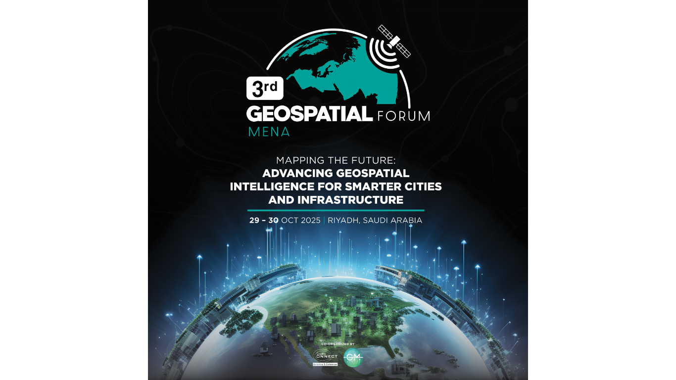
The 3rd MENA Geospatial Forum, taking place on 29–30 October 2025 in Riyadh, Saudi Arabia, marks a significant milestone in advancing geospatial innovation and collaboration across the region. Following two successful editions in the UAE, the Saudi Arabia edition aims to accelerate the Kingdom’s journey toward a data-driven, sustainable, and smart future — in alignment with Vision 2030.
Under the guidance of the General Authority for Survey and Geospatial Information (GASGI), Saudi Arabia has made remarkable progress in strengthening its Geospatial Information Systems (GIS) framework. The establishment of the National Spatial Data Infrastructure (NSDI) has been instrumental in consolidating foundational data — including topography, hydrography, and imagery — to support national goals in urban planning, environmental conservation, smart-city development, and disaster management. The NSDI also enhances transparency, governance, and evidence-based decision-making across multiple sectors.
Across the Kingdom, giga-projects such as NEOM, The Line, AlUla, ROSHN, and the Red Sea Development are leveraging geospatial technologies to shape next-generation cities through advanced mapping, digital twin modeling, and resource optimization. Recent initiatives like drone mapping in Al-Jouf underscore the growing role of geospatial tools in municipal planning and smart infrastructure. Simultaneously, academia–industry partnerships and upskilling programs are helping build national expertise, reinforcing Saudi Arabia’s leadership in the regional geospatial ecosystem.
Globally, the geospatial industry is valued at over $500 billion, with a socio-economic impact exceeding $7.3 trillion, and attracting investments surpassing $200 billion in recent years. Its applications span energy, defense, telecommunications, infrastructure, environment, and land administration, demonstrating its vital contribution to sustainable economic development.
The 3rd MENA Geospatial Forum will gather government authorities, giga-project developers, private companies, consultants, and academic leaders to explore innovative applications, discuss regulatory frameworks, and address challenges related to data accessibility, privacy, capacity building, and rapidly changing technologies. The forum’s discussions will also emphasize how international frameworks such as IGIF (Integrated Geospatial Information Framework) can be adapted to streamline data flow and enhance interoperability across organizations.
Key topics at the forum will include:
- Strengthening Saudi Arabia’s geospatial infrastructure under Vision 2030.
- Integrating GIS for smart-city development and national planning.
- Enhancing data security, governance, and accessibility.
- Applying geospatial analytics for environmental and infrastructure monitoring.
- Building regional capacity and advancing technical skills in geospatial disciplines.
Positioned as the only GIS-focused commercial event in Saudi Arabia, the 3rd MENA Geospatial Forum offers a unique platform that combines a strategic conference and an interactive exhibition — bringing together solution providers, technology innovators, and end-users under one roof. It stands out for its regional relevance, addressing pressing issues specific to the Saudi and MENA geospatial landscape, including water resource management, infrastructure development, and sustainability.
Through thought-provoking sessions, case studies, and networking opportunities, the event will foster dialogue among decision-makers and innovators who are shaping the future of geospatial technology in the region.
The 3rd MENA Geospatial Forum is not just an event — it is a platform for progress, where leaders and experts come together to map the future of geospatial transformation and unlock new possibilities for the Kingdom’s data-driven and sustainable development.
World Business Outlook is the Official Media Partner for this Event


")